
01Prevent false dispatches
Targeted De-icing
Shift from reacting to surprise accretion events to scheduling proactive crew runs on priority spans with quantified false-dispatch risk.
When rime ice builds up on a transmission line, it’s already too late. The escalating weight and drag can lead to line clashing, flashovers, and catastrophic outages. For decades, utility companies have been forced to react to these events, often scrambling crews, managing costly repairs, and dealing with grid instability.
What if you could move from reaction to prevention?
Reliable, asset-level rime-ice forecasts have been missing from the operator's toolkit for two simple reasons:
Our collaboration with Hydro-Québec validates this new approach. By post-training Silurian’s GFT weather foundation model with data from Hydro-Québec’s own network of icing sensors, we created GFT-HQ.
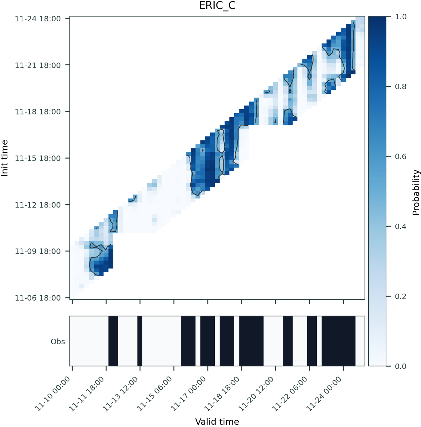
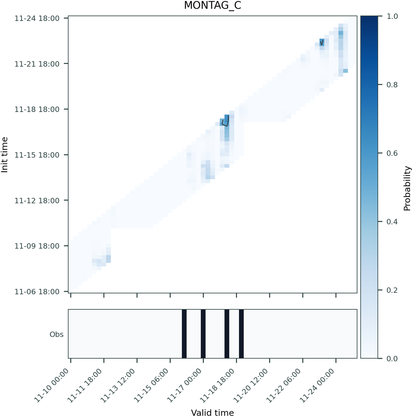
This model learns to natively forecast rime-ice, rather than just post-processing a NWP forecast. The result is a new, operational capability: GFT-HQ achieves an Average Precision of 0.73 for day-ahead rime-ice detection. This provides operators with a reliable, full-day warning that aligns directly with their existing planning windows.
AP = 0.37
AP = 0.72
Beyond aggregate skill, we also analyzed the model's ability to capture high-impact episodes that posed particular challenges for Hydro-Québec’s operations.
Shift from reacting to surprise accretion events to scheduling proactive crew runs on priority spans with quantified false-dispatch risk.
Fuse probabilistic icing trajectories with your DLR engine so you can preemptively derate corridors before load threatens system stability.
Fold weather-driven outage probabilities into hedging, unit commitment, and congestion planning to improve revenue capture.
Leverage the same GFT backbone to enhance wind, temperature, and precipitation guidance wherever sensors report.
As atmospheric volatility increases, the cost of a failed forecast is amplifying. To move beyond simple precision to true decision optimization, a new approach is required.
The GFT-HQ model proves this new capability is unlocked by post-training weather foundation models with high-value, operational sensor data.
Don't just monitor. Predict. See how your sensor network can power a new class of high-precision forecasts. Read more in the preprint here.
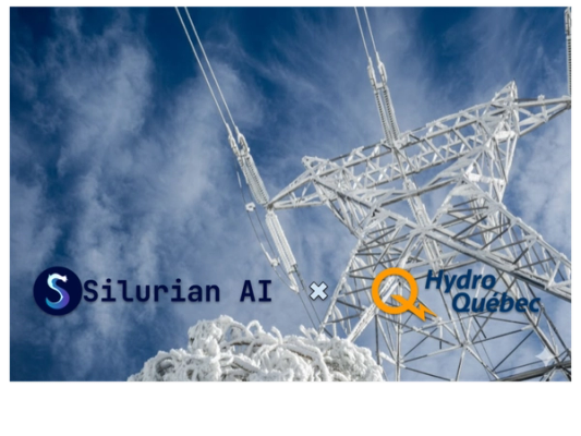
Silurian and Hydro-Québec partner up to train Silurian’s Generative Forecasting Transformer (GFT) on utility-grade grid observation data to capture asset-level details and provide early warnings for catastrophic icing events. These results were recently presented at a CIGRE 2025 keynote.
Silurian Team
October 8, 2025
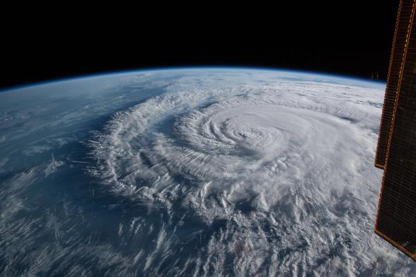
A quiet Pacific storm and a raging Atlantic hurricane present vastly different forecasting challenges. See how Silurian's GFT-C model provided critical, early predictions for both Henriette's peaceful dissipation and Erin's explosive intensification, showcasing the power of advanced machine learning to bring clarity to chaos.
Silurian Team
August 19, 2025